Remote Sensing and UAV’s Newsletter Feb 2016
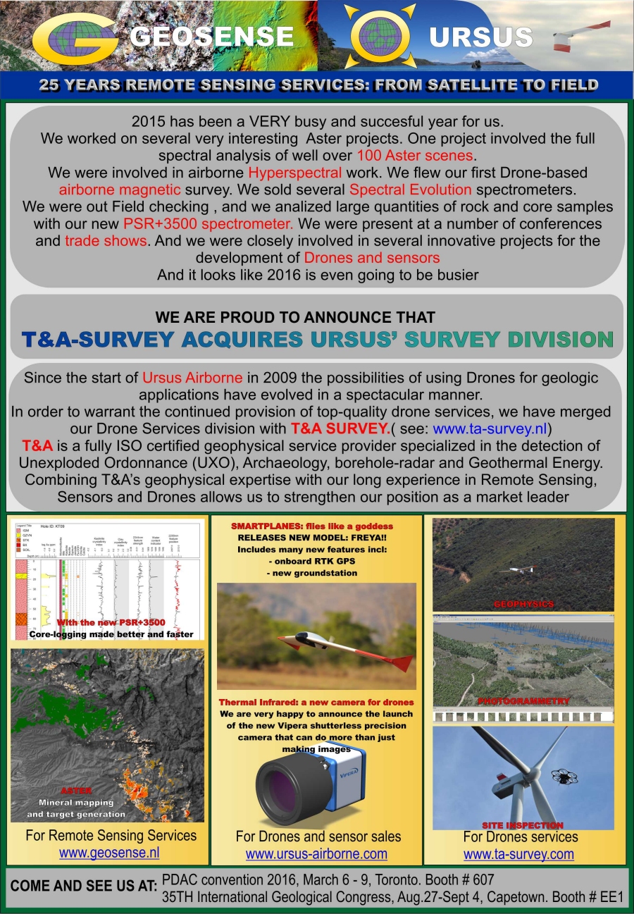
GEOSENSE is a reputable remote sensing consultant specialised in Satellite remote sensing and field spectroscopy. Ours services include:
- Processing of optical imagery such as Landsat, Aster, Ikonos, Quickbird, GeoEye and WorldView2
- Custom made Colour Composites, Ortho-images, Digital Elevation Models, topographic basemaps etc.
- Spectral analysis, Alteration Mapping and Target Generation
- Specialists in Epithermal, Mesothermal, Porphyry, IOCG and Lateritic mineralisation
- Environmental monitoring of mining projects
- Structural analysis and terrain analysis
- Hyperspectral analysis
- Spectroscopic ground truthing and alteration mapping
- Spectroscopic core-logging
- Environmental mapping and vegetation monitoring
URSUS-AIRBORNE is a highly innovative company that provides airborne services using microlight and Unmanned aircraft.
- We integrate new miniaturised sensors with unmanned aircraft
- We provide airborne services
- We are distributor for Smartplanes UAV, Geocopter UAV, High-Eye Helicopter UAV,UAV-borne LIDAR, Spectral Evolution portable spectrometers and Agisoft photogrammetric software.
More News
{{ commodity.name }}
{{ post.title }}
{{ post.date }}
Comments