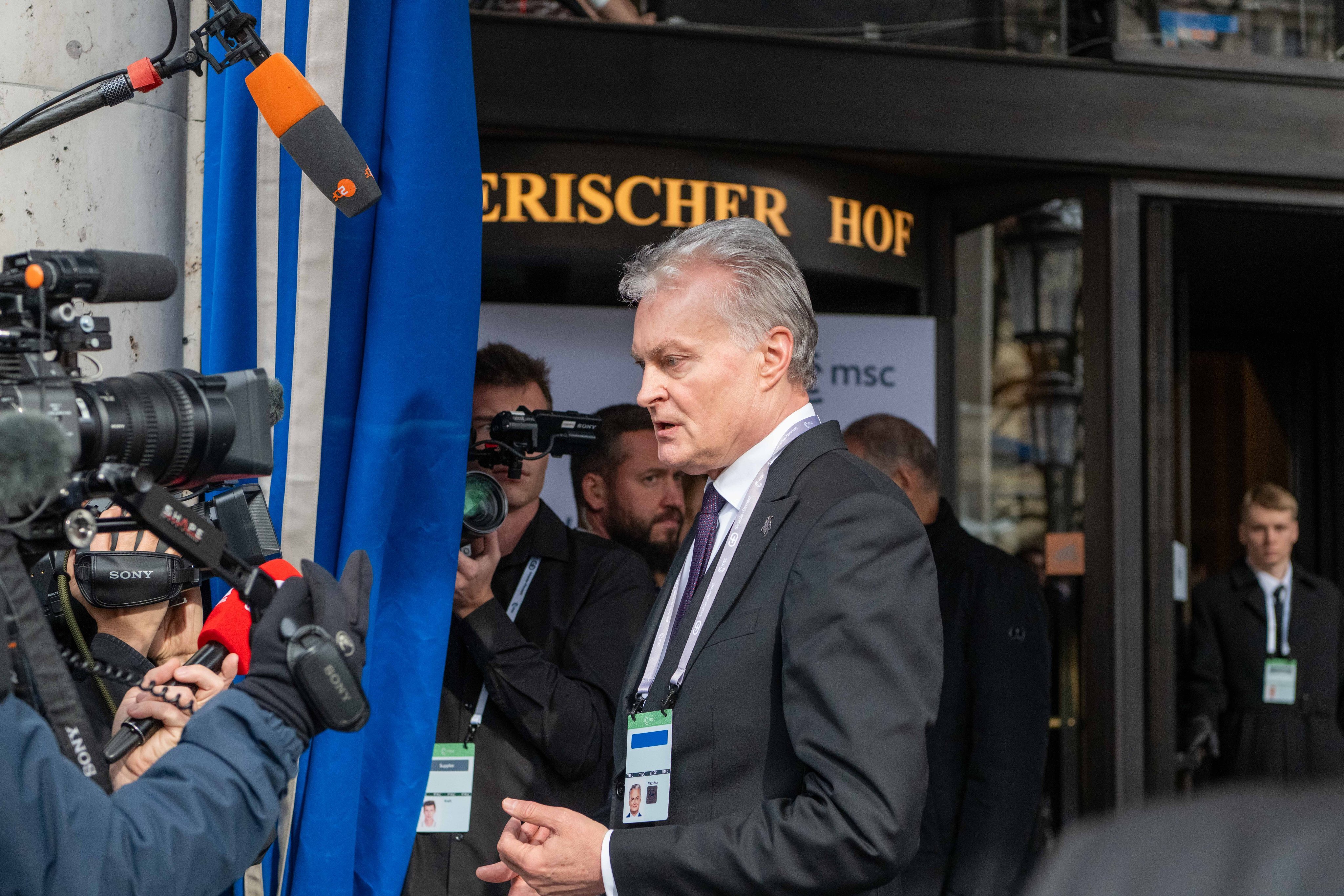
Geovariances announced release of Isatis 2012
Avon, France – Geovariances (http://www.geovariances.com/), a global leader in geostatistical solutions, is pleased to announce the release of the latest version of its featured software solution Isatis 2012.
New to Isatis 2012 is an exclusive feature long time expected by geostatisticians: an advanced automatic variogram fitting tool.
“This tool is unique in the world of geostatistics software as it is the only one that handles complex variography and allows quick and high-quality fitting of multivariate, multi-directional and multi-structure variograms,” said Laurent Wagner, Isatis Product Manager. “The user has just to select a set of basic combinations of structures and the program is able to compute the best fit of the variogram model against the input experimental Variograms,” he explained.
The algorithm used is based on quadratic optimization methods. Its strength lies in the fact that it is able to identify anisotropies and to optimize variogram ranges, sills, and other involved parameters for each basic structure, each simple or cross-variogram, in all directions of the space simultaneously.
“The important benefit of this unheard-of feature is that, when combined with Isatis batch procedures, it allows the set up of efficient automatic estimation workflows using models adjusted at best,” Laurent Wagner added. “It makes the update of resource models with new data easy and fast and improves user’s productivity.”
Another noteworthy development of Isatis 2012 is Flumy, a new geological modeler for meandering channelized systems. Flumy offers a pioneering way of modeling sedimentary deposits thanks to the combination of process-based and stochastic approaches. It involves geological parameters derived from logs and a priori knowledge of the depositional environment.
“Flumy is unique in modeling the reservoir inner geometry with such a “geological” reality,” said François Geffroy, Geovariances R&D Manager. “Hence, models built with Flumy constitute a meaningful input for optimum oil recovery, water supply or CO2 storage studies,” he added.
The model is based on the evolution in time of the channel by migration, cut-off and avulsion, and on the deposition of sedimentary bodies. It is able to generate various fluvial deposit elements such as point bars, crevasse splays, overbank alluvium, sand and mud plugs.
“Flumy originates from the eponym research consortium from the Geostatistics Group from Mines ParisTech. We have entirely re-designed it so that it perfectly fits in Isatis,” mentioned François Geffroy. “It is a complement to other Isatis facies modeler such as the plurigaussian simulations and the multi-point statistics for which it can be used to generate training images.”
Isatis 2012 new capabilitities also include:
– The ability to compute Grade Tonnage Curves from block simulations computed on Selective Mining Units or on panel grids. The existing Grade Tonnage Curves, which derives curves from kriging results, has also been enriched with the ability to handle 2D block models with a given thickness (i.e. stratiform deposits) and irregular block models.
– The ability to interpolate directional data – directions or anisotropy systems – in the scope of Local Geostatistics. Angular information can also be quality controlled with Isatis 3D Viewer.
Learn more about Isatis 2012 at http://link.geovariances.com/isatis2012.
About Isatis
Isatis is a software package which:
– Provides the most comprehensive range of geostatistical tools,
– Manages efficiently multi-million cell grid models,
– Enables users to build efficient workflows from batch procedures, which can be re-run automatically.
More about Isatis at http://www.geovariances.com/en/isatis-isatis-technical-features-ar68.
About Geovariances
Geovariances is the world leader in geostatistics software.
Geovariances aims to provide customers in the Mining, Oil & Gas and Environmental industries and others involved in mapping, resource estimation and risk analysis, with the most complete solution in geostatistics – innovative methodologies, software packages, consulting and training services.
Created in 1986, Geovariances has sold more than 1500 licenses of its flagship geostatistics software package Isatis to 500 leading multinationals including Areva, BHP Billiton, CEA, EDF, Ifremer, Petrobras, Rio Tinto, Shell, Total.
Geovariances is committed to technology innovation and high-quality long-term relationships with its customers and offers several important research programs.
For more information, visit www.geovariances.com
{{ commodity.name }}
{{ post.title }}
{{ post.date }}
Comments