Incorporate Quantec’s Deep Imaging technology to increase drilling efficiency at the mine
Quantec, a global geophysical surveys company has been operating since 1986. With leading geophysical technology focused on providing accurate images of the subsurface their survey programs have resulted in improved drilling efficiencies and lead to discovery.
With technical hubs in Canada, USA, across South America and Australia access to advanced geophysical imaging has never been easier. The company has performed over 100 mine site and near mine imaging surveys globally.
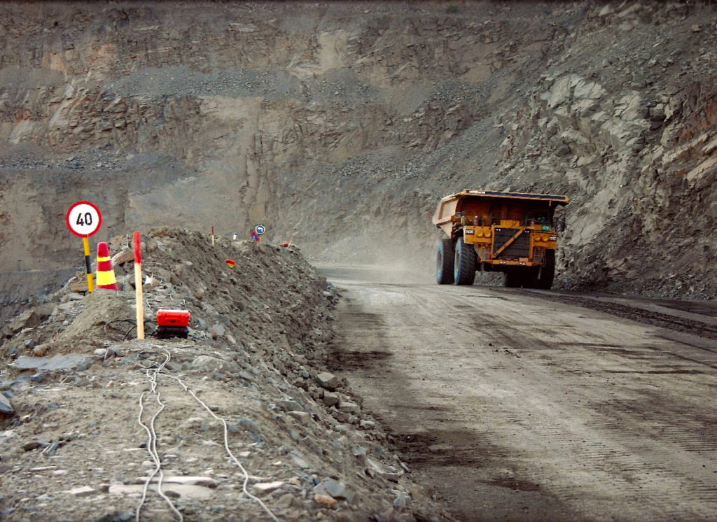
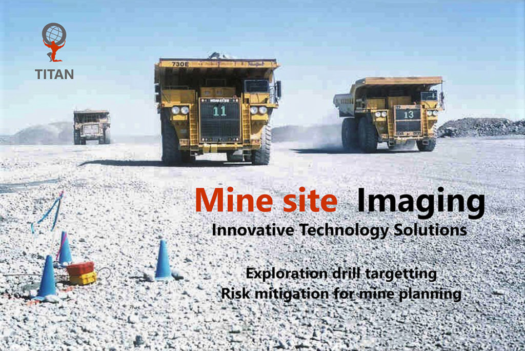
Mine site Imaging
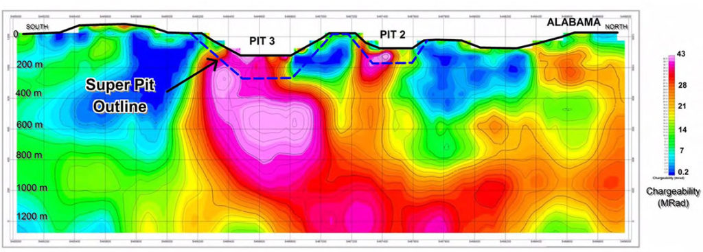
Technology advances: over the last 20 years Quantec has developed significant deep imaging systems for thorough ground mapping and drill target optimization. Quantec uses their own proprietary imaging systems; TITAN 2D and ORION 3D systems are set up to collect multiparameter information about the subsurface and can rapidly produce images from surface to depths of 1000 metres and more.
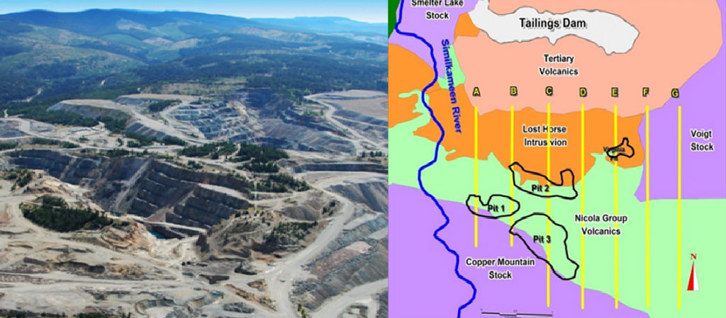
A vast amount Resistivity, conductivity and chargeability data is collected to produce large scale multiparameter images of the subsurface which are critical to discriminating key features such as geology, structural information and ore.
TITAN results have led to significant cost savings, new discoveries, and mine life extension. For complex geological environments full 3D surveys utilizing ORION 3D technology provide even greater imaging capability.
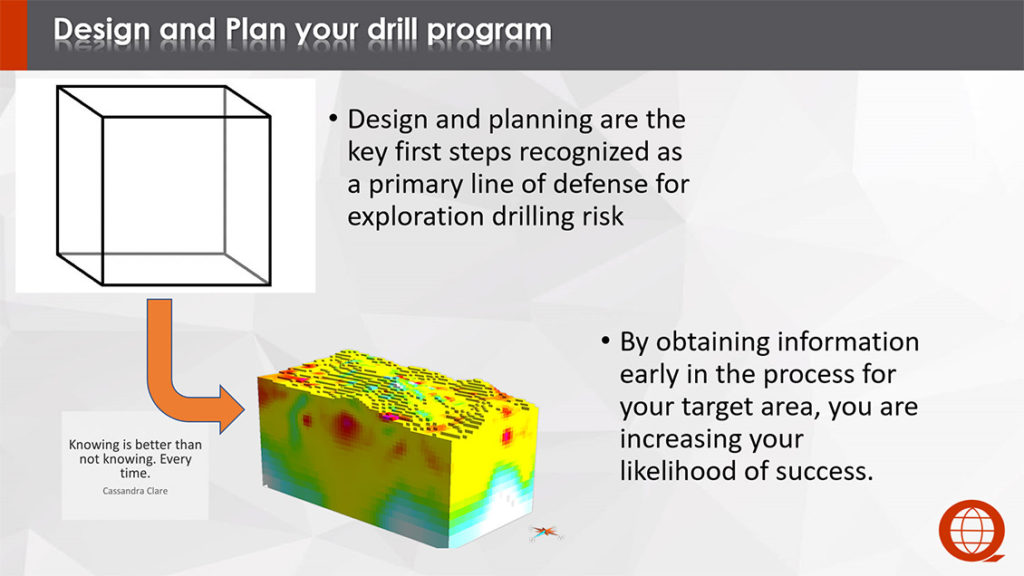
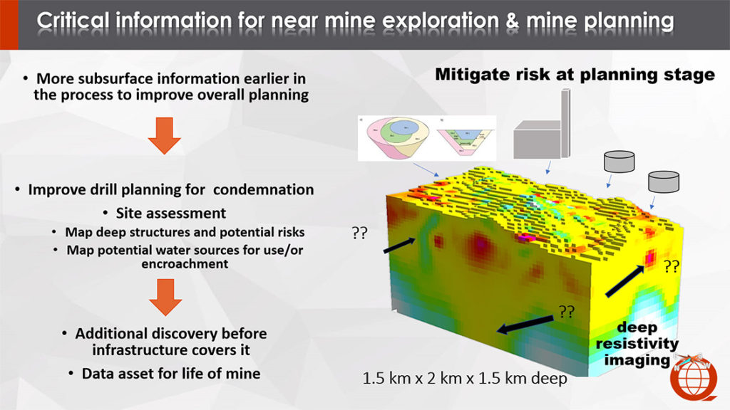
Providing key information about the subsurface is critical to de-risking expensive drill programs and driving more informed decisions and discovery.
Applications:
Exploration
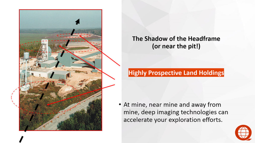
- Delineation surveys to highlight productive zones and extend mine life
- Near mine exploration surveys to identify nearby targets to feed infrastructure
Mine planning:
- Condemnation surveys for drill planning and environmental assessment
- Pre infrastructure and tailings planning
Download a detailed overview and case examples of these technologies in action.
Contact Us Today!
For more information on earth imaging for mine planning and exploration or call 647 228 9577 ask for Rob Gordon.
{{ commodity.name }}
{{ post.title }}
{{ post.date }}
5 Comments
HERMAN L GODOY VIZCARRONDO
I am interested to know what are you offering
Robert Gordon
Hi Herman– many apologies. The Mining.com people did not make me aware of the comment section.
please email me rgordon@quantecgeoscience.com to ask any specific questions…
Thanks
William A Jacobs
I am working on a process to “grind” a 100 ft. dia. shaft several miles deep. The grinding would produce a bio
leach able slurry. Call me at 520 205 0115 in Tucson, AZ
Rod Blakestad
I wish to discuss the applicability of Titan 2D and Orion 3D methods to lithium projects in NM and UT and porphyry copper in Sonora, Mexico. Please call.
Graham Hickey
I was wondering if you done the surveying on the said to be biggest mineral mine in the world @ GOSCHEN near SWAN HILL VICTORIA AUSTRALIA 3585