Maximize Tailings capacity and freeboard with PhotoSat surveys
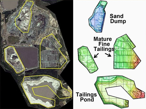
Determine the remaining capacity and freeboard of your Tailings Storage Facility (TSF)
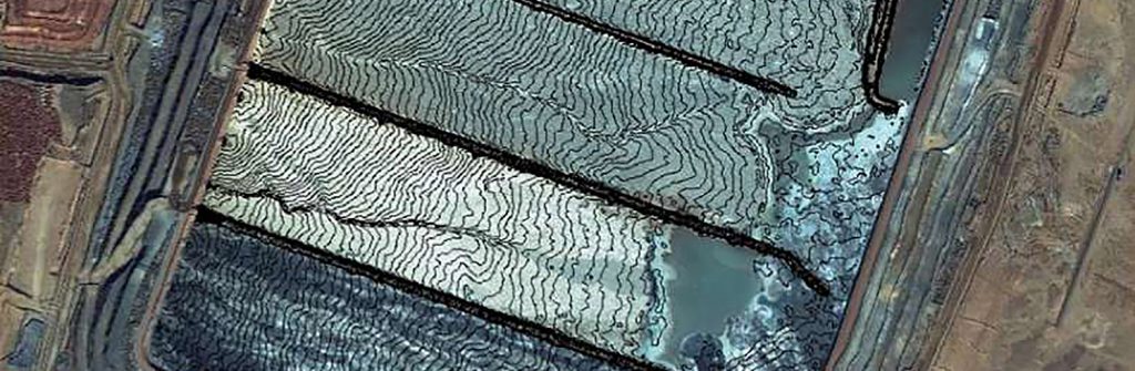
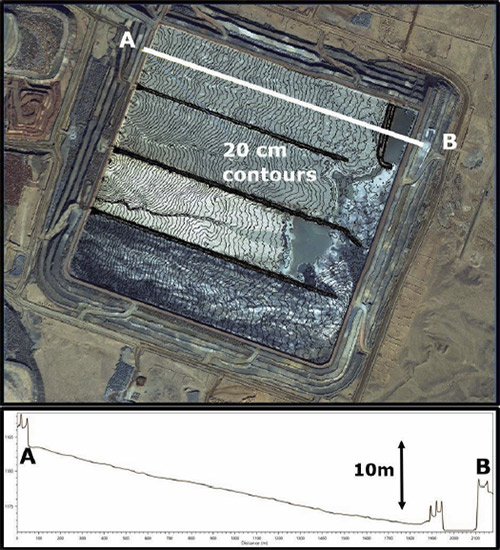
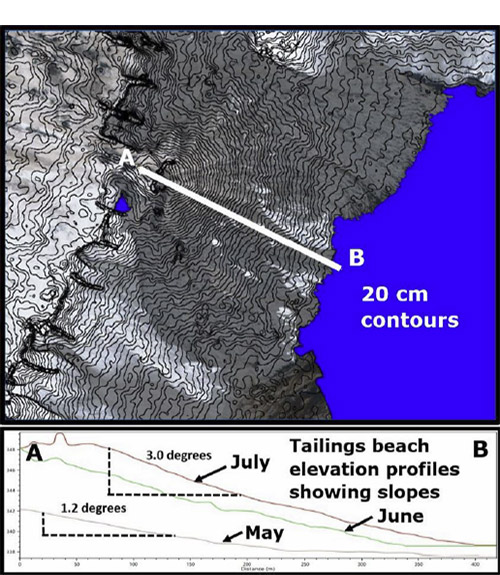
Determining the remaining capacity of your TSF requires accurate and repeatable determination of the edge of the pond and high-density elevation measurements on the beach.
Measuring and monitoring tailings beach slopes and the thicknesses of the pours over time verifies TSF capacity models.
Measure tailings beach slopes
The vertical accuracy of PhotoSat surveying enables you to measure the slopes of tailings beaches to a fraction of a degree.
Tailings beach slopes can be modified by the addition of thickeners and by adjusting the flow volumes from individual tailings spigots.
Completely safe tailings surveying
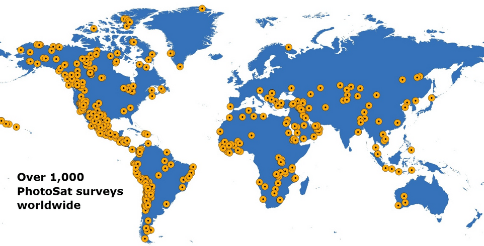
Get consistent TSF survey data anywhere in the world with PhotoSat. Contact us at 604 681-9770
More News
{{ commodity.name }}
{{ post.title }}
{{ post.date }}


Comments