Mine tailings surveying accuracy with a drone survey comparison
To measure tailings beach lift thicknesses and slopes, and the freeboard on the tailings dikes and dam walls, the survey accuracy must be better than 15cm.
- Are your current surveys accurate? How can you be sure?
- Are your current surveys consistent and repeatable or do you get different results from each new survey?
- Do consulting engineering companies recognize the accuracy and reliability of your tailings survey data?
- Does your TSF survey data pass the independent safety audits?
Accuracy measurement
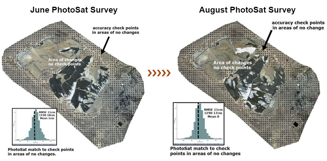
Figure showing hundreds of PhotoSat survey checkpoints and histograms of the match of the PhotoSat survey to the checkpoints.
Subsequent PhotoSat surveys have near-identical matches to the checkpoints.
The mean elevations of the PhotoSat surveys almost perfectly match the mean elevations of the checkpoints.
Learn more about tailings survey accuracy with the full report

{{ commodity.name }}
{{ post.title }}
{{ post.date }}


Comments