Monitor tailings facility construction and operation with PhotoSat surveys
Learn how to get independent, auditable records of TSF construction and operations.
1. Completely safe tailings surveying
2. 15 cm elevation survey accuracy
3. Timely delivery of survey data
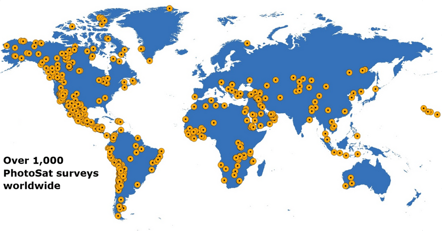
PhotoSat has surveyed over 1,000 projects worldwide. Many of these are operating mines surveyed to 15 cm elevation accuracy.
PhotoSat can help you do this.
View the Full Report
Benefit from PhotoSat’s experience surveying hundreds of mining projects
Independent, auditable, archive of tailings structure construction
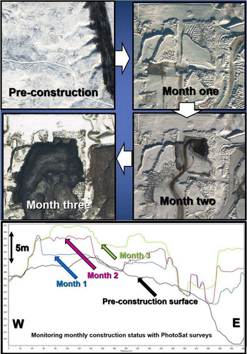
Monthly PhotoSat surveys are used as monthly snapshots during mine site and TSF construction. They also form an independent, auditable record of the TSF construction that can be used for future modifications or expansions of the TSF.
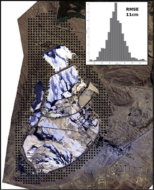
15 cm elevation surveying accuracy required for TSF surveys
Most tailings surveying requires accuracies of better than 20cm in elevation. The Canadian Oil Sands Innovation Alliance (COSIA) in their 2015 publication, “Guidelines for Tailings Deposit Sampling and Measuring Tools” specify the required accuracy of TSF surveys as follows: Aerial surveys survey (of the pond hard bottom) should have and accuracy of +/- 15 cm.
Completely safe tailings surveying
PhotoSat’s mine site surveys are completely safe. There is no requirement for any on site presence of PhotoSat survey personnel. The PhotoSat 1m survey grids are derived from high resolution satellite photos taken 600 km above the mine site. No one on site is even aware when the satellite photos are taken. PhotoSat can references the first survey to your existing as built mine survey data or your existing survey targets. Each subsequent PhotoSat survey is referenced to the first PhotoSat survey so there is no need to maintain or update the ground targets. If new infrastructure or ground targets are installed and surveyed by your existing mine survey team these can be verified and incorporated into the next PhotoSat survey, whether they are within or far from the active mine areas.
Get a proposal for your mine site here or contact us at 604 681-9770
{{ commodity.name }}
{{ post.title }}
{{ post.date }}


Comments