Scaling Earth Observation: Moving from ad-hoc data to a unified geospatial strategy in mining
How global mining enterprises are eliminating operational friction to transform remote sensing into a core driver of safety, efficiency, and sustainability.
Some mining organizations are just beginning their Earth observation (EO) journey with a successful pilot. Others are already heavy users, maintaining sophisticated in-house GIS departments. Regardless of maturity, the challenge today is rarely a lack of data. It’s much more likely to be the friction of turning that data into an integrated operational framework.
While remote sensing is an effective way to monitor multiple sites and remote assets, most organizations struggle to move toward a unified geospatial strategy. By shifting from ad-hoc data procurement to a unified operational model, mining companies can transform their EO data usage into a core driver of safety, efficiency, and sustainability across their entire portfolio.
Exploration and site selection
Traditional ground-based exploration can be costly and time-consuming. Rather than looking for a needle in a haystack, modern geology teams can use Earth observation data to narrow down their target areas. By utilizing a “Tip & Cue” strategy, geologists can leverage free, open-source data to identify large-scale geological anomalies before tasking high-resolution satellite assets for precise field targeting. Hyperspectral and SWIR (short-wave infrared) imagery, such as from WorldView-3, can identify specific mineral signatures and alteration zones that are invisible to the naked eye.
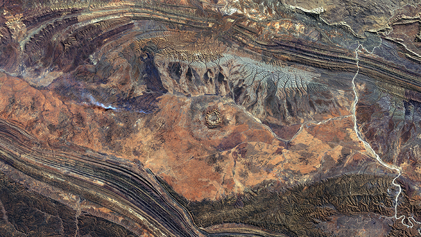
Beyond mineral mapping, satellite data and elevation models provide a deeper understanding of terrain and hydrology. This insight helps teams plan initial access routes and optimal sites for exploration drilling, while providing the foundational data required to support feasibility studies and evaluate overall mine planning options.
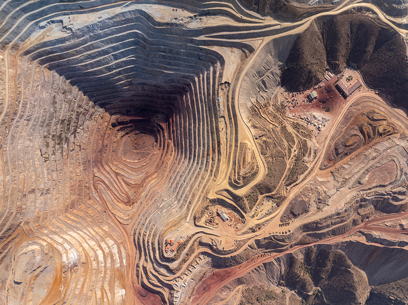
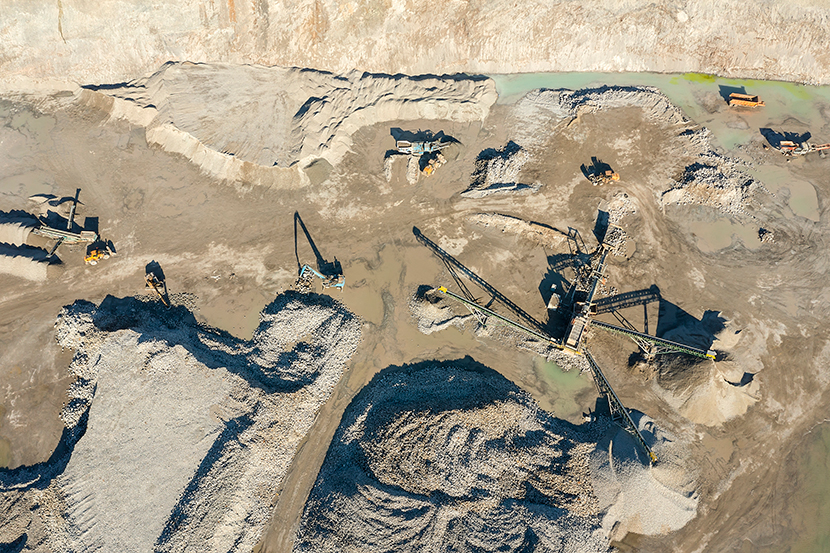
Monitoring site progress
Once a site is active, the challenge shifts to the frequency and reliability of monitoring. High-frequency tasking from providers like BlackSky and Airbus allows for near real-time construction monitoring. Repetitive automated tasking helps track infrastructure development, audit stockpile inventory, and ensure open pits conform to mine plans.
By digitizing the monitoring of field resources and road conditions, operators move away from manual site checks toward a proactive, data-driven management style that can be replicated at every asset.
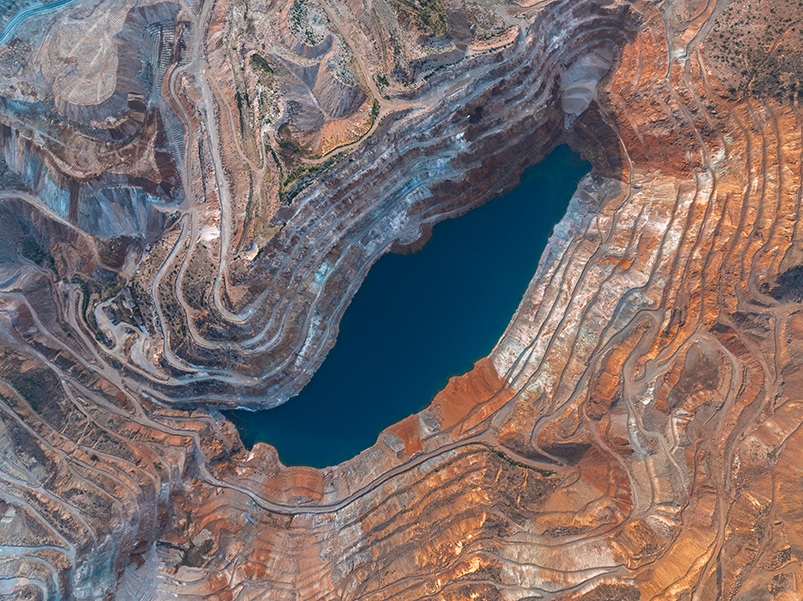
Asset integrity and multi-site risk management
Safety remains the top priority for mining operations, especially regarding tailings storage facilities and open-pit slopes. While ground-based monitoring systems are still the main tools used on-site, InSAR serves as a powerful addition, helping teams see the bigger picture by detecting millimetric surface movements over time. Accessing SLC data from providers like Airbus, ICEYE, and Capella Space provides the foundational information required to power these precise stability assessments and catch potential risks early.
In a unified geospatial environment, these insights aren’t siloed in a single department. Instead, millimetric deformation data becomes part of a centralized risk management dashboard, helping corporate teams maintain oversight of geotechnical stability across dozens of global sites simultaneously.
Environmental compliance and ESG
Modern mining requires transparent environmental reporting. Remote sensing data provides an immutable, permanent record of reforestation efforts, water quality, and land cover changes. Access to a vast historical archive is a strategic necessity for legal compliance.
During site closures, fresh high-resolution imagery documents successful reclamation, providing the definitive evidence needed to satisfy regulators and maintain corporate ESG commitments consistently across all regional operations.
Why scaling EO across mining operations remains a challenge
Despite the clear benefits of EO intelligence, mining enterprises often run into operational friction when trying to scale operations from one site to fifty.
- Fragmented procurement: A single mine site might require SAR for stability, optical for construction, and hyperspectral for exploration. Managing dozens of disparate vendors, each with their own contracts, portals, and pricing models, creates an administrative bottleneck.
- Operational silos: Every new area of interest often triggers a fresh round of legal and financial reviews. For global mining houses, decentralized sourcing across teams leads to a lack of transparency. This frequently results in expensive, duplicate data purchases over overlapping concessions and missed opportunities for group-wide volume discounts.
- Technical complexities: Converting raw pixels into actionable insights requires specialized engineering. When data arrives in inconsistent formats or through manual downloads, it prevents the creation of automated, repeatable workflows that can be deployed globally.
- The multi-site visibility gap: Without a unified platform, it’s nearly impossible to standardize monitoring protocols across sites to gain a true enterprise-wide view of risk and progress.
The role of geospatial platforms in unifying infrastructure
Centralized geospatial platforms solve these barriers by acting as the geospatial operating system for the mining lifecycle. Rather than managing dozens of individual relationships and custom integrations, these platforms provide a unified infrastructure to access and manage the world’s largest geospatial repositories.
Standardized and centralized procurement
Modern geospatial platforms unite optical, SAR, lidar, hyperspectral, and elevation data into a single environment. Whether an operator needs all-weather reliability with SAR, stereo tasking for volume assessments, or hyperspectral / SWIR data for mineral identification, the complexity of managing multiple commercial contracts and data formats is handled automatically.
Automated integrations
Advanced APIs and Python SDKs offered by platforms like UP42 allow engineering teams to build automated pipelines directly into existing GIS workflows. By delivering standardized, analysis-ready data, these platforms ensure teams spend less time on manual downloads, inconsistent data formats, and pre-processing, and more time on high-value analysis.
Enterprise governance & security
A centralized platform approach ensures visibility into spending, maximizes volume discounts, and protects sensitive proprietary data under strict industry standards like SOC 2 Type II and GDPR.
Strategic advisory
Beyond simple troubleshooting, dedicated experts from leading platforms act as an extension of in-house geospatial teams. They provide the specialized guidance required for complex, cross-sensing tasking and success planning tailored to the unique geospatial demands of the mining lifecycle.
Standardizing the approach to geospatial data
The transition toward unified platform structures represents a shift in how the mining industry perceives geospatial intelligence: no longer as a series of isolated data purchases, but as a foundational layer of core operations.
Platforms like UP42 are engineered for enterprises that need to manage massive volumes of data and complex cross-team coordination. By unifying data, processing, and vendors into a single ecosystem, mining companies eliminate the friction of fragmentation. This model saves costs while gaining the visibility and agility required for long-term, sustainable growth in an increasingly complex global landscape.
Free industry report: Earth observation in mining
This comprehensive report provides a practical overview of how EO data can improve operational decision-making and business performance across the mining lifecycle. Download the report to explore:
- An exploration of data challenges faced by modern mining enterprises.
- Real-world use cases for Earth observation data across active workflows.
- Methods for deploying geospatial data at scale without extensive in-house engineering expertise.

{{ commodity.name }}
{{ post.title }}
{{ post.date }}
Comments